
Looking back at Lancaster and Morecambe’s lost windmills
If, on a nice clear sunny day, you find yourself on Morecambe promenade, take a look across the bay to the west of Barrow-in-Furness where, in the distance, you can’t fail to see the serried ranks of wind turbines lining the horizon.
Despite being ten miles off Walney Island their sheer size makes them difficult to ignore, some of the more recent arrivals being taller than Blackpool Tower.
Trying to count them may take you some time - they actually number 327! In 2025 these turbines played a major role in wind power becoming the largest single source of electricity in the United Kingdom.
While using the wind to generate electricity is a relatively recent development - the first commercial wind farm in England was in Cornwall in 1991 - harnessing the wind to provide power for a variety of agricultural and industrial purposes has a much longer history.

The building that performed these functions was the turbine’s ancestor - the windmill. It is thought that windmills originated in the Middle East and were probably introduced to England by the Normans.
The earliest written record of a windmill in this country dates from 1185 AD, although it was not until 1270 AD that an illustration appeared.
This showed a simple wooden box-like structure with sails covered in cloth.
The wind turned the sails which, through a system of gears, turned the grindstones inside the mill to produce flour.
By the end of the 14th century windmills were a common sight across England, particularly in the drier eastern part of the country where fast-flowing streams for watermills were not so plentiful.
As technology advanced over the years windmills became larger and more efficient with multiple sets of grindstones and many of the old wooden mills, susceptible to rot and fire, were replaced by
stone towers.
This was the case on the Fylde in Lancashire, the rich agricultural region between Preston and Fleetwood where corn growing was widespread.
In 1879 seventeen windmills were recorded in operation, justifiably earning the Fylde the nickname ‘Windmill Land’. However, north of the Fylde windmills were few and far between.
There were isolated examples in Lancaster, Morecambe, Bolton-le-Sands and Heaton but none was still standing by the close of the 19th century.
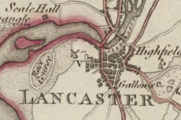
Marsh Mill in Lancaster is thought to have been built around 1760 and is clearly shown next to the racecourse on William Yates’ 1786 map of Lancashire.
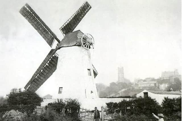
Located at the bottom of West Place it was a small tower mill of three floors with a boat-shaped cap and four cloth-covered sails.
If the wind changed direction the miller could turn the cap and sails by pulling on a chain suspended from the wheel at the rear of the cap.
The tower probably contained two sets of millstones which would have been used for grinding barley or oats rather than wheat which preferred a drier climate.
The photograph, with the Castle and Priory Church in the background, dates from around 1875 and the man posing at the gate is likely to be the last miller Nicholas Barnes.
The mill itself was owned by John Whiteside who had a corn merchant’s business in Damside Street.
The end for Marsh Mill came in 1880 when Lancaster Corporation bought it to clear the site for houses.
In its issue of February 7 the Lancaster Gazette, with a tinge of sadness, described the mill being dismantled.
"The heavy sails are being taken down; so that the dwellers in that neighbourhood will hear no more the groaning and creaking and whirring of the old mill on wild and windy nights.
"The solid tower has stood for years unimpaired, and to all appearances it is strong enough to stand for another century or two longer.
"But it must come down, it is said. By no one person will the fate of the old mill be more keenly felt than by the old man who has tenanted it for so long and been happy in it for over thirty years.
"It is one of the misfortunes of “improvements” that the Corporation deprive certain people of their livelihood."
Today the only reminders that Marsh Mill ever existed are a street sign and a fast food shop bearing the name ‘Windmill Takeaway’ at the junction of Lune Road and Willow Lane.
A windmill once stood on the seafront at Morecambe, next to some fishermen’s cottages, on a piece of flat land known as Battery Point.
On Yates’ map it was named Heysham Mill being just over the boundary line from Poulton-le-Sands (as Morecambe then was).
It was probably older than Lancaster’s Marsh Mill and certainly closed well before the latter.
When it ceased working the top part of the tower was removed, a roof was added and it became a dwelling called the Round House.
The last occupant was Betty Hudson but before her another old lady lived there. She was Ann Woodhouse, around 90 years of age and bedridden, but she liked having visitors and would welcome
them propped up in bed smoking a clay pipe.
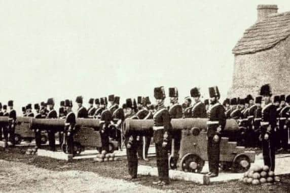
After being vacated the Round House became an ammunition store for the Lancashire Artillery Volunteers who used the land for a battery of guns (hence the name Battery Point) from where they
practised firing at targets in the bay.
Erosion of the shoreline led to the soldiers relocating to Scalestones Point near Bare and in 1899 the mill and cottages were demolished to make way for a much larger Battery Hotel, the Palace
Theatre and several shops.
There was also a windmill in Bolton-le-Sands, at the end of Mill Lane opposite what is now Bay View Garden Centre.
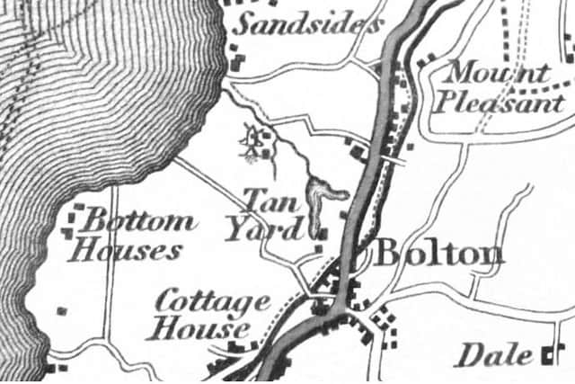
Built around 1780 it is marked on George Hennet’s 1828 map of Lancashire and made the news in December of that year when the Lancaster Gazette reported that during a violent thunderstorm ‘lightning struck the windmill at Bolton-le-Sands, carrying away the shafts with the sails, etc. and doing other considerable damage - the fields, etc. were thickly covered with hailstones for sometime afterwards. Fortunately no person was injured.’
Repairs were carried out and the windmill worked for a few more years before eventually closing in about 1850.
Although shown on Yates’ map, little is known about the windmill which once stood on high ground near the township of Heaton, neither when it was built nor when it closed.
It must have been a good spot for a windmill as four sizeable turbines have recently been erected in the vicinity.
Whether or not these modern incarnations of the picturesque windmills of the past are considered a blight on the landscape or an acceptable source of ‘green energy’ in a changing climate will, no
doubt, long remain a matter of opinion.
*Barry Guise is the co-author of 'The Midland Hotel: Morecambe's White Hope' and 'In The Swim: Morecambe's Super Swimming Stadium'.