
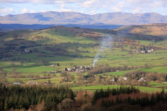

Running from Lancaster to Keswick, it passes through the glorious heart of the Lake District, stopping on the way at various towns and villages including Kendal, Windermere, Ambleside and Grasmere.
From a seat on the top deck, you’ll be able to gaze down on serene Rydal Water and Thirlmere, and crane your neck to stare up at some of Lakeland’s most majestic mountains including Helvellyn.
There are memorable walks to be enjoyed from just about every bus stop – from relaxing valley strolls to more strenuous high-level hikes.
The frequency of the service also makes it easier to set out on a linear journey by foot, walking from one bus stop to another – a particularly satisfying experience.
Spoilt for choice, guidebook writer Vivienne Crow managed to whittle down her favourite walks from the 555 to a list of just 10.
Advice before you set off
Make sure you’ve got a map and are equipped for whatever the weather might throw at you. If you’re heading to the fells, check out the Adventure Smart website for advice.
For information on bus times, go to the Stagecoach website or download the Stagecoach Bus app from Google Play or Apple’s App Store.
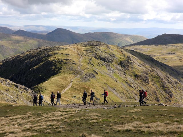
5. Walk 5: Fairfield Horseshoe
Start/finish: Ambleside bus interchange, Kelsick Road. Length/difficulty: 11½ miles, hard, approximately 6½ hours. Map: Ordnance Survey OL7, English Lakes SE and OL5, English Lakes NE. For more serious hill walkers, this is one of Lakeland’s classic horseshoe routes taking in a series of summits along the high ridges that cradle the head of Rydal Beck. It involves a fairly long day on the fells, most of it at an altitude where the weather can be prone to sudden change. But those who come prepared will be in for a treat, particularly those who enjoy gazing off to distant horizons - because of its central location, the views of the surrounding fells are superb. Ascending via Nab Scar, the walk takes in Heron Pike, Great Rigg, Fairfield (at 2,863ft/873m, the highest of the bunch), Hart Crag, Dove Crag, High Pike and Low Pike. The ridges are broad enough to allow you to stride out without fear of falling but narrow enough to give that sense of freedom that comes from walking along a raised spine of earth. Underfoot, the paths are generally grassy with some stonier sections and occasional peaty patches. Photo: VIVIENNE CROW
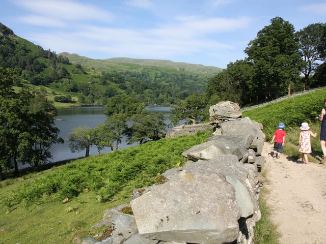
6. Walk 6: Grasmere and Rydal Water
Start/finish: 555 bus stop near Heaton Cooper Studio, Grasmere. Length/difficulty: 5½ miles, easy, approximately 3 hours. Map: Ordnance Survey OL7, English Lakes SE. Like Ambleside to the south, Grasmere offers a wealth of low-level and high-level walks, as well as everything in between. The circuit of Grasmere’s eponymous lake and neighbouring Rydal Water is a great walk for families, or for when you just want a relatively easy half-day. It visits two of the smallest and prettiest lakes in the Lake District – both right in the heart of Wordsworth country. From Grasmere, follow quiet lanes and pleasant tracks in and out of woodland along the base of the fells. This is the route of the old corpse road, once used to carry coffins from Ambleside to St Oswald’s Church in Grasmere for burial. Dove Cottage and Rydal Mount, two of poet William Wordsworth’s former homes, are passed on this outward leg. Both are open to the public. The second half of the walk takes in shore paths beside the sparkling waters of the two lakes and on returning to the village, there’s the option of visiting the graves of Wordsworth and his family in the churchyard. Photo: VIVIENNE CROW
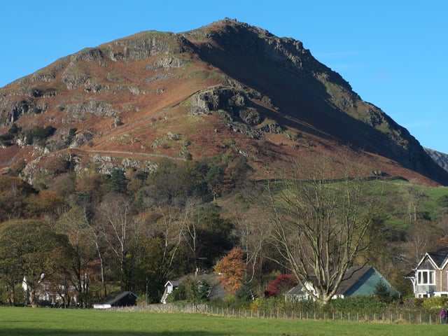
7. Walk 7: Helm Crag
Start/finish: 555 bus stop near Heaton Cooper Studio, Grasmere. Length/difficulty: 4¼ miles, moderate, approximately 3 hours. Map: Ordnance Survey OL7, English Lakes SE. Helm Crag (1,329ft/405m) stands tall above the village of Grasmere, its distinctive summit rocks clearly visible from the A591. It’s a relatively short but steep walk from the 555 bus stop in Grasmere. After following the Easedale Road away from the centre of the village, ascend the well used path up to the first group of rocks – The Lion and The Lamb. There’s some easy scrambling to stand atop the rocks, or you can take the bypass path to the left. The highest rocks on the ridge make up a formation known as The Howitzer. While the scrambling on The Lion and The Lamb is straightforward, climbing to the top of The Howitzer is much trickier and should only be attempted by the surefooted. Indeed, it is the only one of 214 peaks that defeated the guidebook writer Alfred Wainwright. Having enjoyed spectacular views from both sides of the ridge, descend a zig-zagging path to Greenburn, a tranquil side valley that sees few visitors. From here, quiet lanes lead back to the bus stop in Grasmere. Photo: VIVIENNE CROW
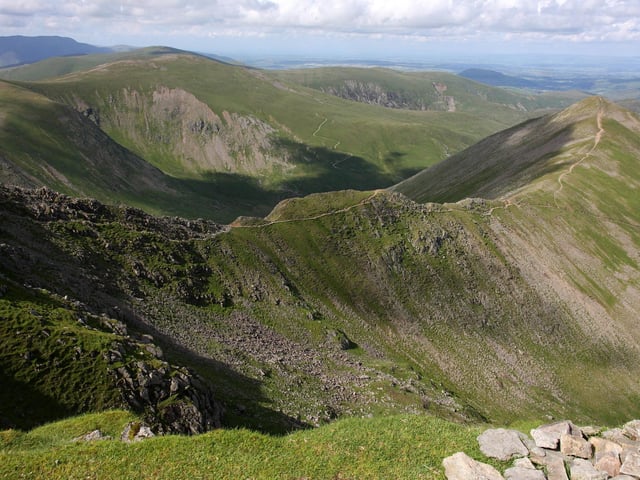
8. Walk 8: Helvellyn (linear from Dunmail Raise to Swirls car park)
Start: 555 bus stop at Dunmail Raise. Finish: 555 bus stop at Swirls car park. Length/difficulty: 6 miles, hard, approximately 4½ hours. Map: Ordnance Survey OL5, English Lakes SE The 555 bus passes directly below the western slopes of the Helvellyn range so it’s ideal for tackling linear walks on England’s third highest mountain. Routes range from just under six miles to almost 15 miles if you want to bag all the tops along the ridge. One of the shorter options starts at Dunmail Raise and ends at Swirls. It ascends to the beautifully located Grisedale Tarn via Raise Beck before embarking on the zig-zag path up Dollywaggon Pike, the southernmost peak in the range. It’s a tough slog to the top but once you’re there, it’ll feel like you’re on top of the world. Ahead lies more than a mile of easy, high-level ridge walking – a chance to peer down on the rocky aretes and secret coves carved by glaciers thousands of years ago. The view from the summit of Helvellyn (3,116ft/950m) takes in the famous aretes of Striding Edge and Swirral Edge. Be careful to locate the correct path down from the top. It heads north-west from Lower Man, over the top of Browncove Crags, then skitters down to the Swirls bus stop. Photo: VIVIENNE CROW