Great views on one fell swoop


Its dense plantations of larch have suffered in recent years from disease, necessitating extensive harvesting of its slopes.
There are still enough trees to allow the walk to enjoy this upland, but elsewhere one hopes the new plantings will quickly restore the attractiveness of the fell.
Directions:
Advertisement
Hide AdAdvertisement
Hide AdFrom the war memorial, walk the short distance to Clitheroe Road and turn right. Keep on this as it dips to an enchanting wooded dell with cottages to the right, and then climb up to the church of St John the Evangelist.
The route turns right on to the track alongside the church, but in the grounds there is a noteworthy monument. An obelisk marks the grave of Ikaturo Sugi, described as a Japanese subject, who died in 1905 at the age of 30.
The young man was a journalist and translator, whose health suffered during China’s Boxer Rebellion of 1900. (Readers may remember the Charlton Heston film 55 Days in Peking, which depicted these events.) In the early years of the 20th century, Sugi was receiving treatment in England for tuberculosis, but by autumn 1905, realising there was little hope, moved from Southport to Stonyhurst, where he had friends. This corner of a country churchyard will be forever Japan.
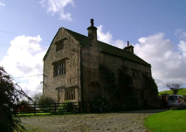
Beyond the church, turn left on to a lane and continue for 250m, and then by a cluster of properties turn right onto a bridleway. This leads up to the imposing farmhouse of Greengore, characterised by its heavy duty stone buttresses.
Advertisement
Hide AdAdvertisement
Hide AdPass the farmhouse to your left on a track that leads alongside one of its outbuildings. Still on a bridleway, this leads up to Crowshaw House about 15 minutes beyond Greengore. Keep ahead through its yard and follow the drive up to Clitheroe Old Road. Turn right and then turn left onto a footpath. Until the recent past this area was densely covered with tall conifers. Not anymore.
Keep on the path as it leads to a brook in 350m, and then continues alongside a fence, beyond which the fields of Green Thorn Farm come into view. Keep on the path as it leads up, skirting the farm, and then climb behind it. Just under 400m from the farm, you arrive at a broad forestry track. Cross this to follow the path up a firebreak between stands of trees.
When you reach a second forestry track turn right. 750m along the track turns sharply right, but before following it a short distance from its bend, by keeping ahead you’ll come to a fine viewpoint and picnic spot overlooking the Vale of the Hodder.
On retracing your steps follow the main track to the next junction and turn left and follow this forestry track for the next 1.6km (25 minutes) until you reach Clitheroe Old Road. Turn left.
Advertisement
Hide AdAdvertisement
Hide AdAfter 200 m, and as the road bends to the right steeply downhill, turn right on to a footpath at Kemple End, a cluster of attractive houses and cottages. Keep on the track as it bends to the left and then after a farm reaches open fields.
From the gate, bear left to the hedge and follow it round to a stile in the corner. Keep ahead with the fenceline on your right to cross two more stiles, bringing you to the drive of the attractively named Throstle Nest. Follow its drive to the lane.
Turn right, and then in a little under 200m turn left into the ground of Stonyhurst College.
Keep ahead past the main building and chapel, before turning right on to a footpath leading between playing fields and woodland. Keep on the path as it sweeps to the right and follow it back to Hurst Green.
Advertisement
Hide AdAdvertisement
Hide AdRoute described by John Griffiths and Bob Clare. For an illustrated version of this walk go to www.lancashirewalks.com
Start/finish: Hurst Green, the Avenue, close to the war memorial.
Distance: 11km (7 miles)
Time: 3 – 4 hours
Summary: A gentle climb to the main ridge is followed by a gentle descent ending at Stonyhurst College.
Maps: OS Explorer 287 The West Pennine Moors and OS OL 41 The Forest of Bowland.