Community ‘desperate’ for release of Lancaster flooding report four years on from Storm Desmond


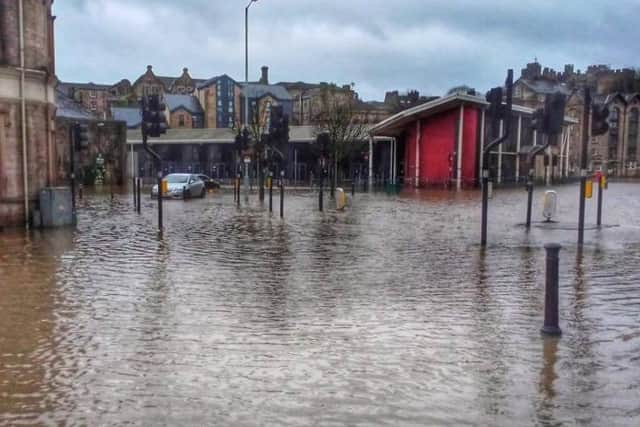
More than four years after the city was hit by Storm Desmond, causing flooding to hundreds of properties, and power outages for days, Lancashire County Council has still not released a full study into what went wrong and how the effects of future floods can be mitigated.
Lancaster City Coun Tim Hamilton-Cox, who represents Bulk Ward, said that the community is “desperate” to know if the council is close to identifying a scheme which will protect properties in the long term.
Advertisement
Hide AdAdvertisement
Hide AdHe said the council needs to “get a proper sense of urgency, stop its endless prevarication, and publish the report”.
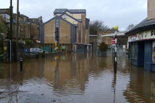
The county council commissioned a report in 2017, and said that this was largely completed in early 2019, however it also said that a further study was needed into the “Mill Race Culvert”, in order to effectively consider options for the future.
The Mill Race is a channel of water that lies underneath some of Lancaster’s low-lying streets.
According to a recent Lancaster University study, during Storm Desmond, the Mill Race was overwhelmed by the volume of rainwater in such a short time period that it flooded the lower part of Lancaster.
Advertisement
Hide AdAdvertisement
Hide AdCoun Hamilton-Cox said: “It’s over four years since the catastrophic city centre flooding of 332 properties; and over three years since the study of the Mill Race and its surface water network was initiated by Lancashire County Council (funded mostly by the North West Regional Flood and Coastal Committee).
“Yet the wider community remains none the wiser about the findings of the study. Ward councillors and the community, especially local businesses, are desperate to know if County is any nearer identifying a scheme to give city centre properties some security from flooding - and the prospect of affordable insurance - for the future.
“I am calling on Lancashire County Council to publish and engage without further delay.”
Rachel Crompton, flood risk manager for Lancashire County Council, said: “Lancaster city centre’s historic drainage network is built of linked systems of pipework which are all underground.
Advertisement
Hide AdAdvertisement
Hide Ad“People have made many isolated alterations to it over hundreds of years.
“To make the best use of public funds now, we have to make assumptions about how these drainage systems work, then test out our assumptions with computerised models, learn from the modelling and improve our assumptions until we understand enough to justify expensive schemes of works to mitigate future flooding.”
A Lancashire County Council spokesman confirmed that work completed at this stage included the catchment analysis, which identified flow paths and where flooding from surface water could be expected.
He said: “Through the use of computer modelling this information has been used to identify and demonstrate the cost associated with damages from different flood events.
Advertisement
Hide AdAdvertisement
Hide Ad“This is necessary for future funding bids to demonstrate the cost benefits of any proposals. However the study also identified that the Mill Race could have a significant impact on any mitigation measures which required further investigation of the structure itself, and this additional work has now been completed.
“We have recently been using this information to identify potential options that could be taken forward to reduce flood risk in the city centre.
“We are due to meet with partners towards the end of January 2020 to consider these options and take a view on their viability, as well as which measures could be delivered relatively quickly, and which may need further work over the longer term.
“Our aim is to publish the report including these recommendations as soon as possible following this meeting and to engage with residents and businesses and agree a way forward.”
Advertisement
Hide AdAdvertisement
Hide AdWork is expected to start this year on a three mile flood wall along the river Lune between Skerton Bridge and the Bay Gateway Bridge.
Contractors are currently working on a diversion route for users of the Millennium Path, which would be re-routed along pavements on Caton Road for the duration of the works.